Getting Here
There are many ways to get here from there — how long it takes depends on how much time you have and what you want to see along the way.
From Denver
Fastest Route
South on Highway 25 through Colorado Springs. Normally the quickest route, but you're traveling through two cities and the traffic in and between can sometimes be messy, especially in summer. Not very scenic for the most part, except that you'll see Pikes Peak from the plains.
If you're planning to visit Pikes Peak, you can hit that along the way from this route. Add 3 hours to the time if you drive up Pikes Peak.
Best if you're in a hurry to make a tour, are driving an RV, or prefer driving large highways.
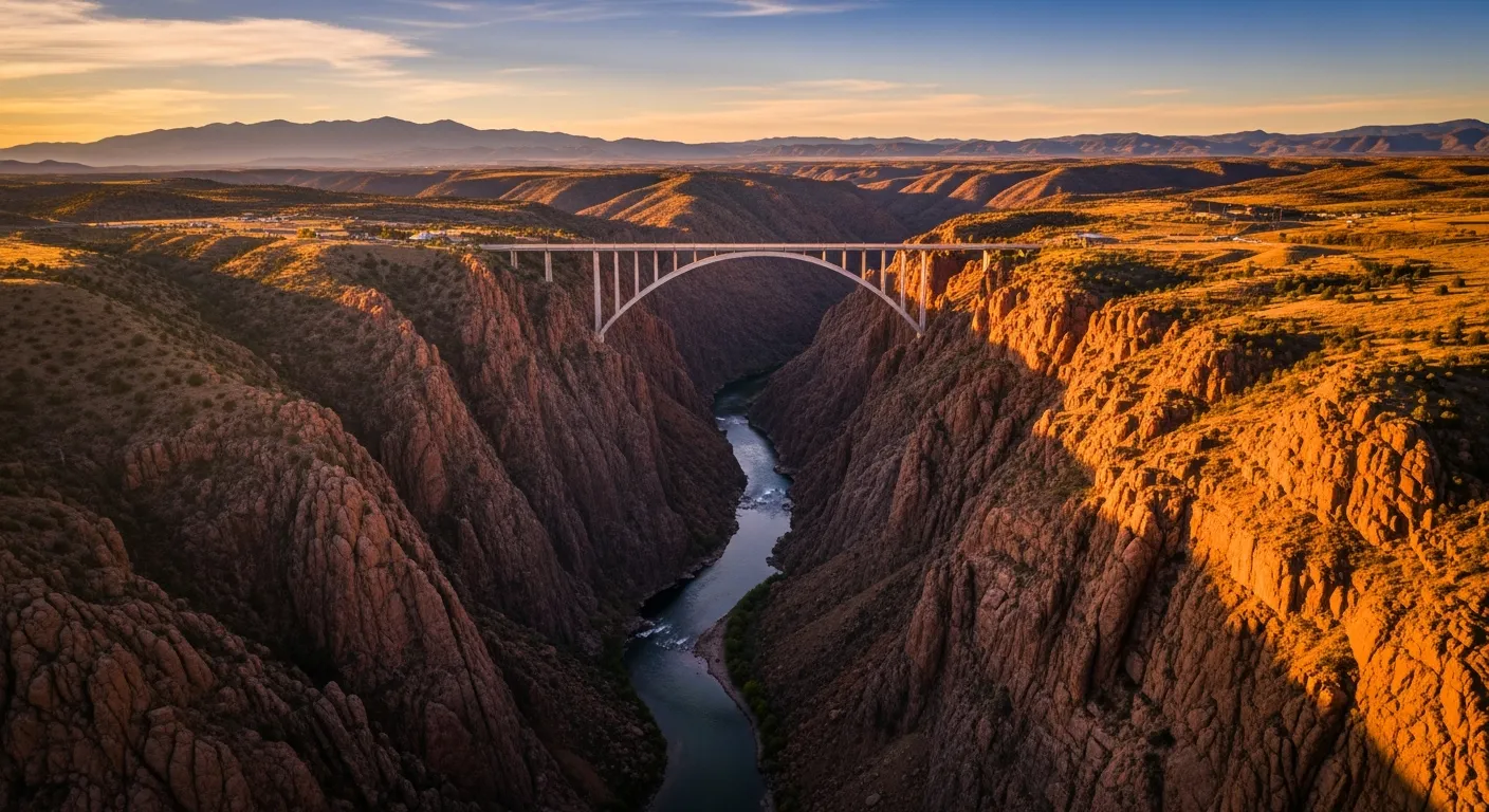
Map & DirectionsScenic Route
THIS is what you came to Colorado to see! Take a half day road trip along Colorado's front range, going southwest on Highway 285 toward Conifer and Pike Junction. Journey along the North Fork of the South Platte River, world-famous for its trout fly fishing. Roll through Woodland Park and take in the majesty of 14,000 foot high Pikes Peak. Head to the tiny historic gold mining town of Cripple Creek, then south on the Gold Belt Scenic Byway to Cañon City.
On the last hour of this drive be sure to watch for abundant deer, elk and antelope.
Best if you want to see Colorado's natural beauty, at a slow pace, on 2-lane scenic roads.
Map & DirectionsFrom Colorado Springs
Fastest Route
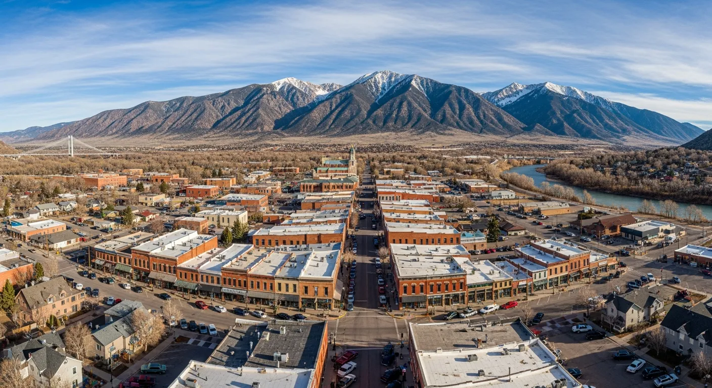
A straight shot southwest on Highway 115, then west on Highway 50, brings you right into the heart of Cañon City.
Best if you are in a hurry to make a morning tour, are driving an RV, or prefer highways.
Map & DirectionsScenic Route
Swing to the north and west of Pikes Peak before heading south to Cañon City. This route takes you around Pikes Peak, through Manitou Springs, past Mueller State Park, the historic gold mining district, and south along the Gold Belt Scenic Byway.
Best if you want to enjoy beautiful scenery and have a chance to spot wildlife, at a slow pace, on 2-lane mountain roads.
Map & DirectionsFrom Breckenridge
Fastest Route
A direct and easy route south on Highway 9, through the small historic towns of Fairplay, Hartsel and Guffey, then east on Highway 50 into Cañon City.
Best if you are in a hurry to make a morning tour, are driving an RV, or prefer highways.
Map & DirectionsScenic Route
Head south on Highway 9 then detour to the southwest through Buena Vista and Salida, before swinging east to Cañon City. This route takes you on curvy roads along the famous Arkansas River, best known for its whitewater rafting.
Best if you want to enjoy beautiful scenery and have a chance to spot wildlife, at a slow pace, on 2-lane mountain roads.
Map & DirectionsFrom Trinidad
Fastest Route
If you're coming from Texas or New Mexico via Trinidad, it's an easy drive north on Highway 25, then west on Highway 50 into Cañon City, on mostly straight roads.
Fastest and most direct route. Not all that exciting but you'll make it here in no time.
Map & DirectionsScenic Route
Although it adds 45 minutes to your drive time from Trinidad, we highly recommend the longer route through Westcliffe, Colorado. Once you hit Gardner, you'll be traveling on easy valley floor roads through large cattle ranches, with the Wet Mountains on your right, and the Sangre de Cristo Mountains on your left. Then, once you hit Texas Creek and go east on Highway 50, you'll be traveling along the mighty Arkansas River most of the way.
Best for cool mountain air, seeing historic cattle ranches, and possibly spotting Bighorn Sheep along the river.
Map & Directions